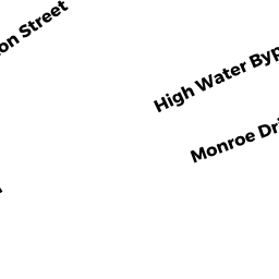
78 MONROE DRIVE
Owner Information
DIAS, JOYCE K TTEE
78 MONROE DR
HOLLISTON, MA 01746


Property Details
78 MONROE DRIVE is classified as a Residential Condominium (Th).
The primary structure on this property was built in 2016. There are 2,290ft2 of built area within this property. This property is listed as having 6 rooms.
78 MONROE DRIVE is valued at $527,800. The land is valued at $0 and the structures are valued at $527,800.
The most recent deed for 78 MONROE DRIVE is recorded at the local registrar in Book 73421, Page 235. 78 MONROE DRIVE was last sold on Tuesday, October 8, 2019 for $1.
Assessment data from fiscal year 2022.
Flood Data
This property is partially within the A Zone (within floodplain). Approximately 3.48 acres (8.28%) of the property is within this zone.
This information is sourced from the FEMA National Flood Hazard Layer. See our full disclamer.
Broadband Internet Providers
| Provider | Type | Bandwidth (mbps) | |
|---|---|---|---|
| T-Mobile | Fixed Wireless | 25 | 3 |
| Viasat Inc | Satellite | 100 | 3 |
| Verizon New England Inc. | DSL | 5 | 0 |
| VSAT Systems, LLC. | Satellite | 2 | 1 |
| HughesNet | Satellite | 25 | 3 |
| Verizon New England Inc. | Fiber | 940 | 880 |
| Comcast | Cable | 1000 | 35 |
| GCI Communication Corp. | Satellite | 0 | 0 |
Broadband service provider data from December 2020.
Adjacent Properties
- 0 WASHINGTON ST TRACT
United States Government owned by REGULATORY OFFICE NEW ENGLAND DISTRICT - 0 WASHINGTON ST ( OFF)
United States Government owned by UNITED STATES OF AMERICA - 0 RAIL ROAD BED
Recreation, Active Use (Charitable Org.) owned by TOWN OF HOLLISTON - 0 WASHINGTON ST
Vacant, Tax Title/Treasurer owned by HOLLISTON, TOWN OF - 0 CHESTNUT ST
Mixed Use (Primarily Agriculture, some Residential) owned by BHC VENTURES, LLC - 56 CHESTNUT ST
Mixed Use (Primarily Residential, some Agriculture) owned by KASE, SANDRA & RICHARD (L/E) - 56 CHESTNUT ST
Electric Generation Plants, Agreement Value owned by KASE, SANDRA & RICHARD (L/E) - 0 CHESTNUT ST
Electric Generation Plants, Agreement Value owned by KASE, RICHARD L(L/E) & SANDRA